Don’t Make This Mistake Hiking Cocora Valley, Colombia
/
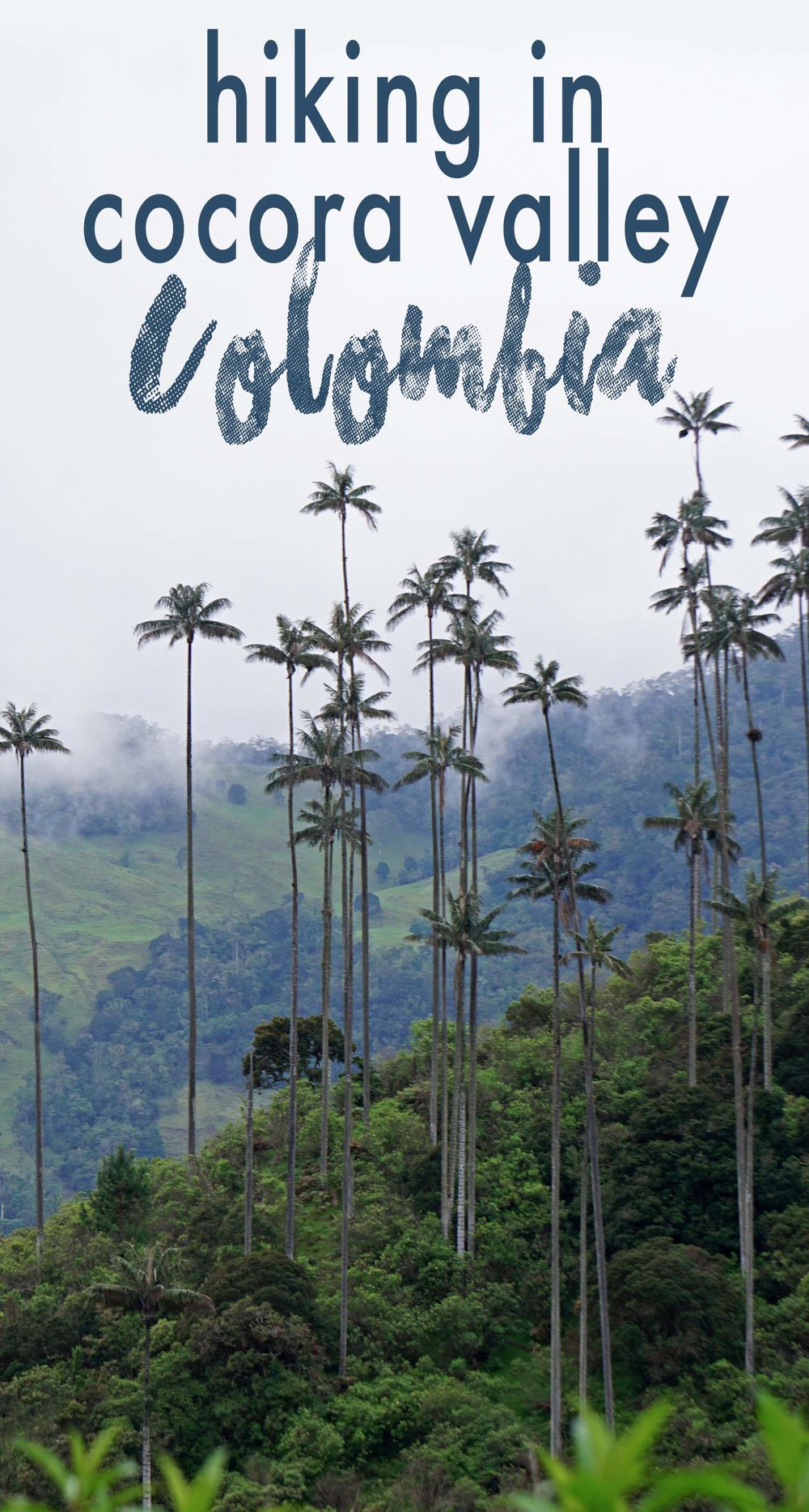
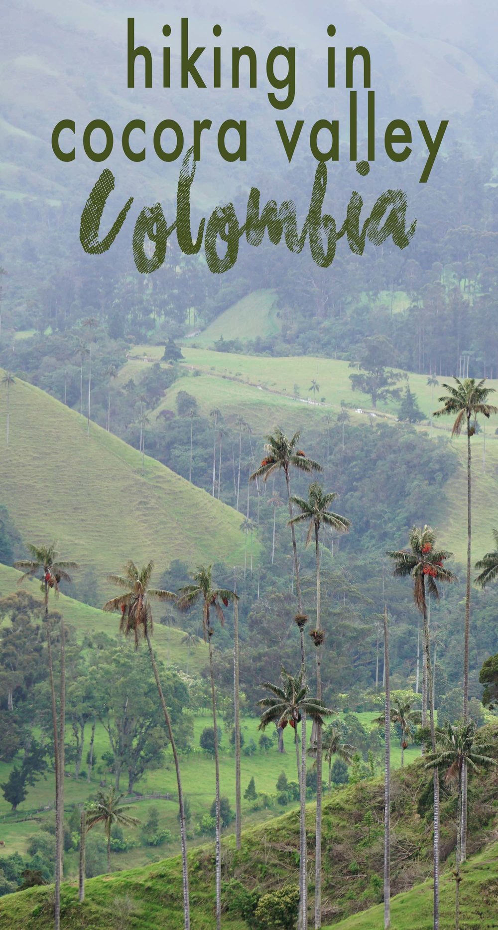
Between the slanted green hills of Cocora Valley, the world’s tallest palm trees comically protrude out from the Earth. Don’t miss this dazzling hiking experience in Colombia.
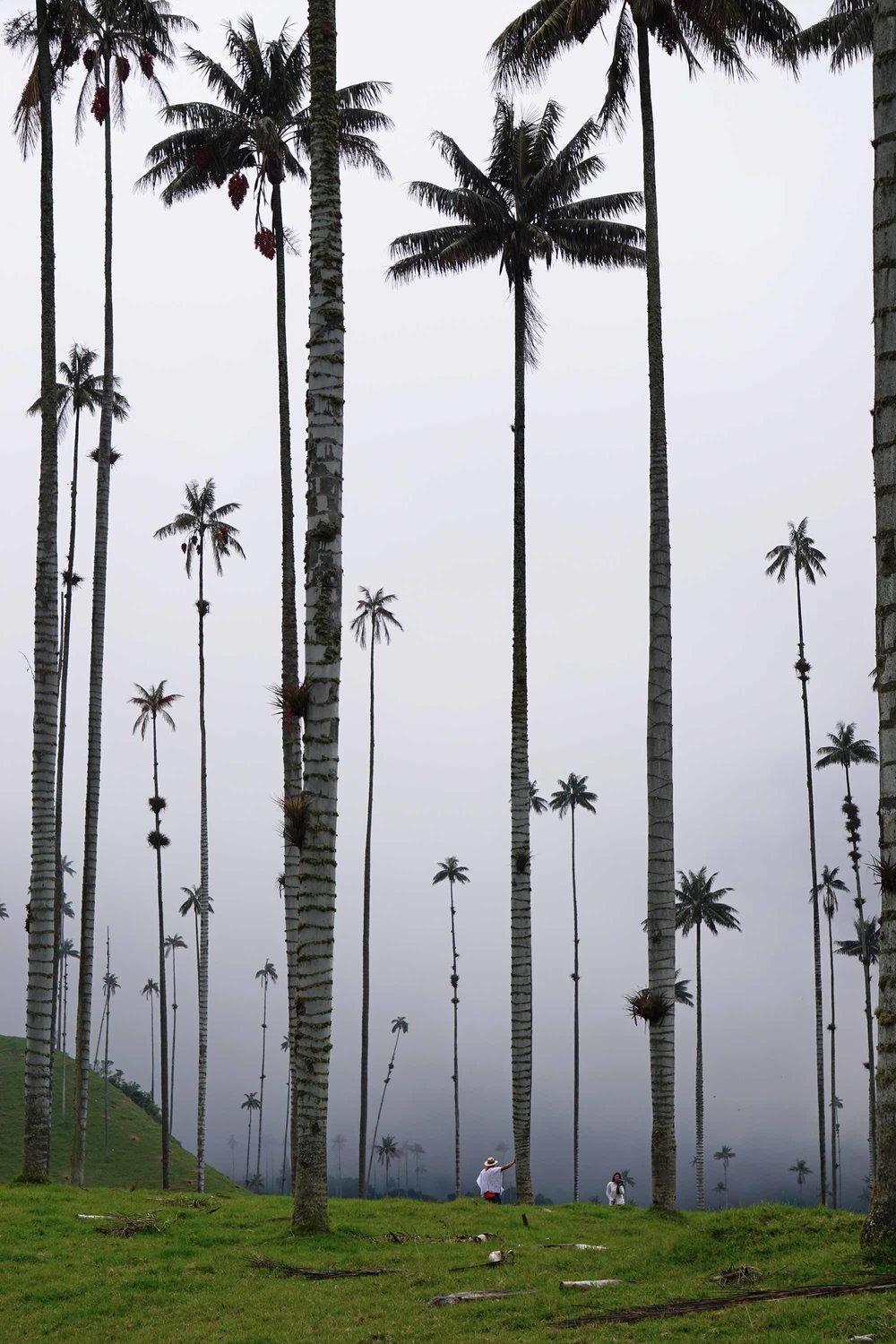
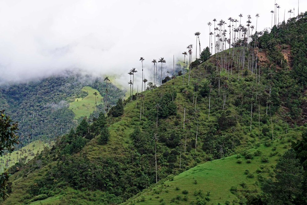
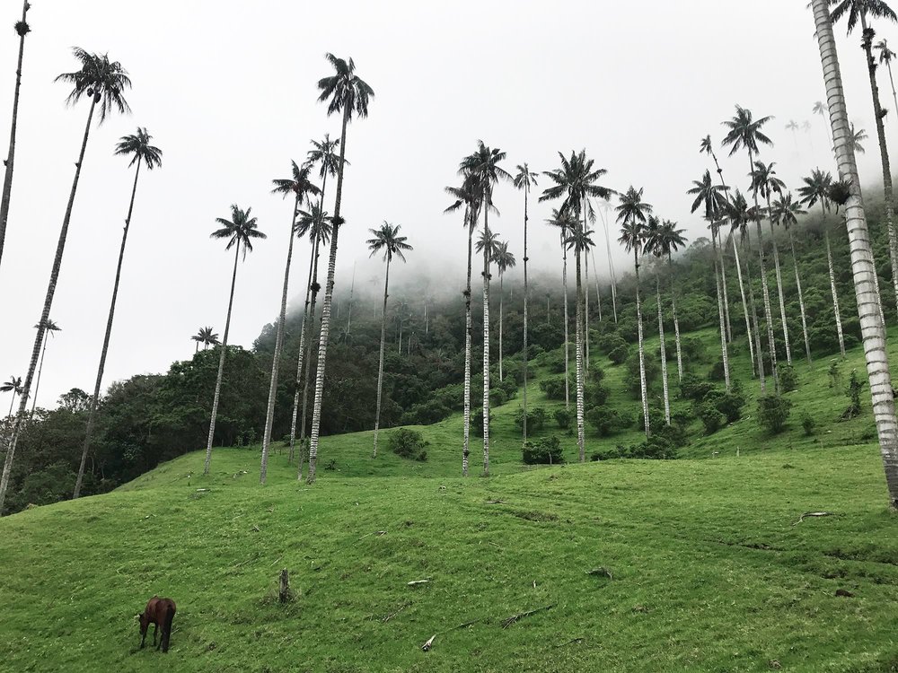
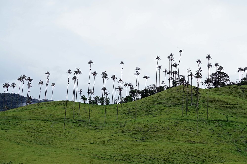
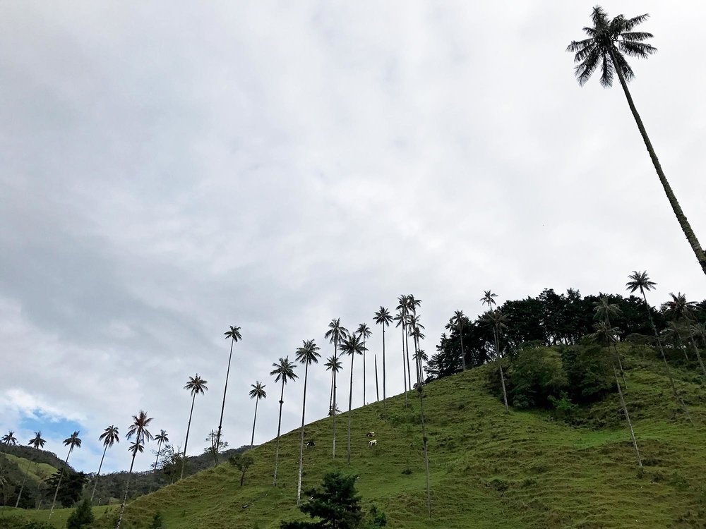
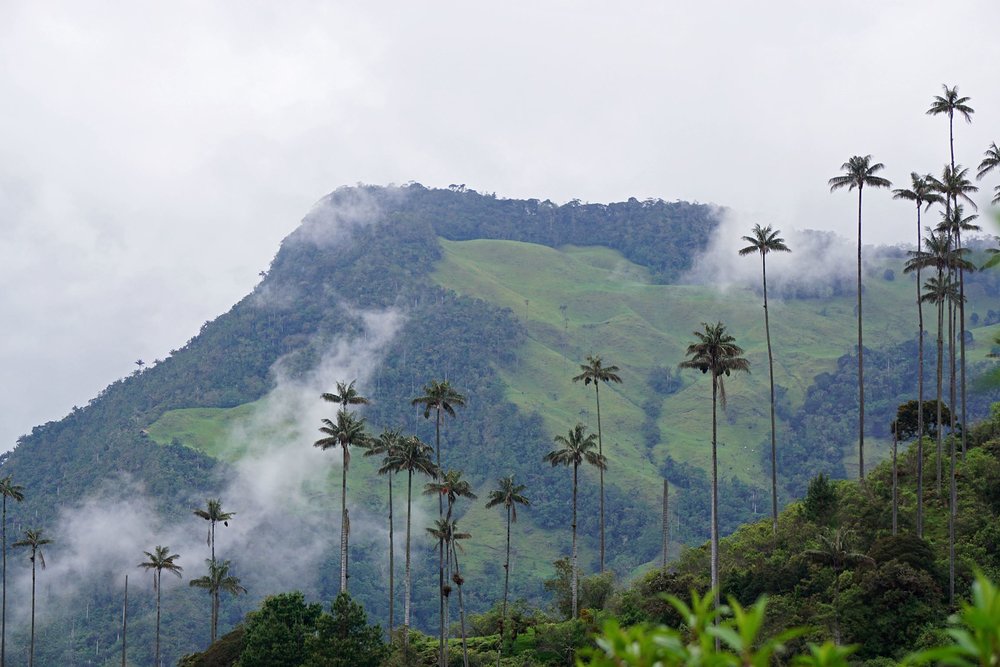
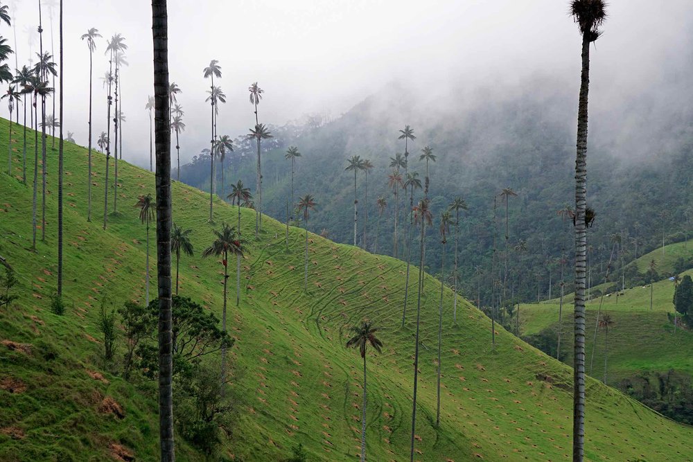
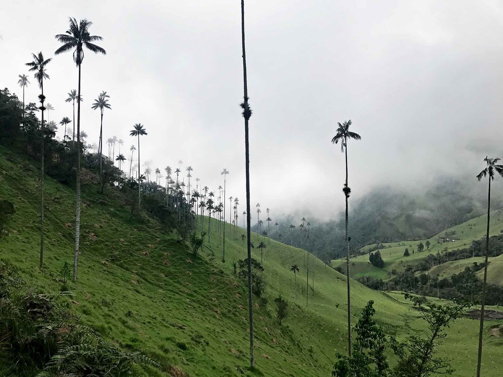
Valle de Cocora, or Cocora Valley is located in the Andean mountains and home to the national tree and symbol of Colombia, the Quindío wax palm.
These slender trees stand at an impressive 60 meters (200 feet!) and mimic something out of a Dr. Seuss book.
Although you can see these palms throughout the Quindío region of Colombia making for a nice surprise while driving through from Jardín to Salento or Salento to Bogotá, the best place to experience the wax palm up close is in the Cocora Valley near Salento in Colombia’s coffee region, Eje Cafetero.
In April 2017 while I was traveling through Central America, I came across a photo of these wax palms in Salento and sent the photo to a good friend who was on her way to Colombia. That photo stuck with me and I dreamed of standing amongst these giants. When I finally made it to Colombia a few months later, Cocora Valley was very high on my priority list of activities.
The Valle de Corora hike was certainly no disappointment.
There are three different options for hiking Cocora Valley, which are explained in detail towards the end of this article. From the three different options, my friend and I chose to take the hardest route. Traveling can’t just be all about eating & drinking – you’ve got to have some balance in the form of exercise!
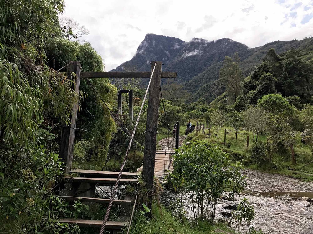
As it’s typically rainy in this region, we traipsed through the muddy trail often holding onto the barbed wire trail lining for support! At the beginning, we made a game out of finding the driest and most supportive place to step to keep our shoes as mud-free as possible. However, we soon gave into the muddy madness.
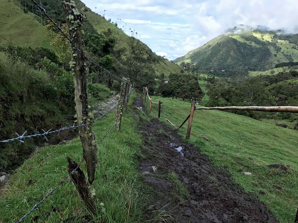
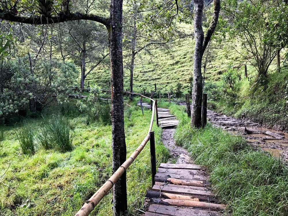
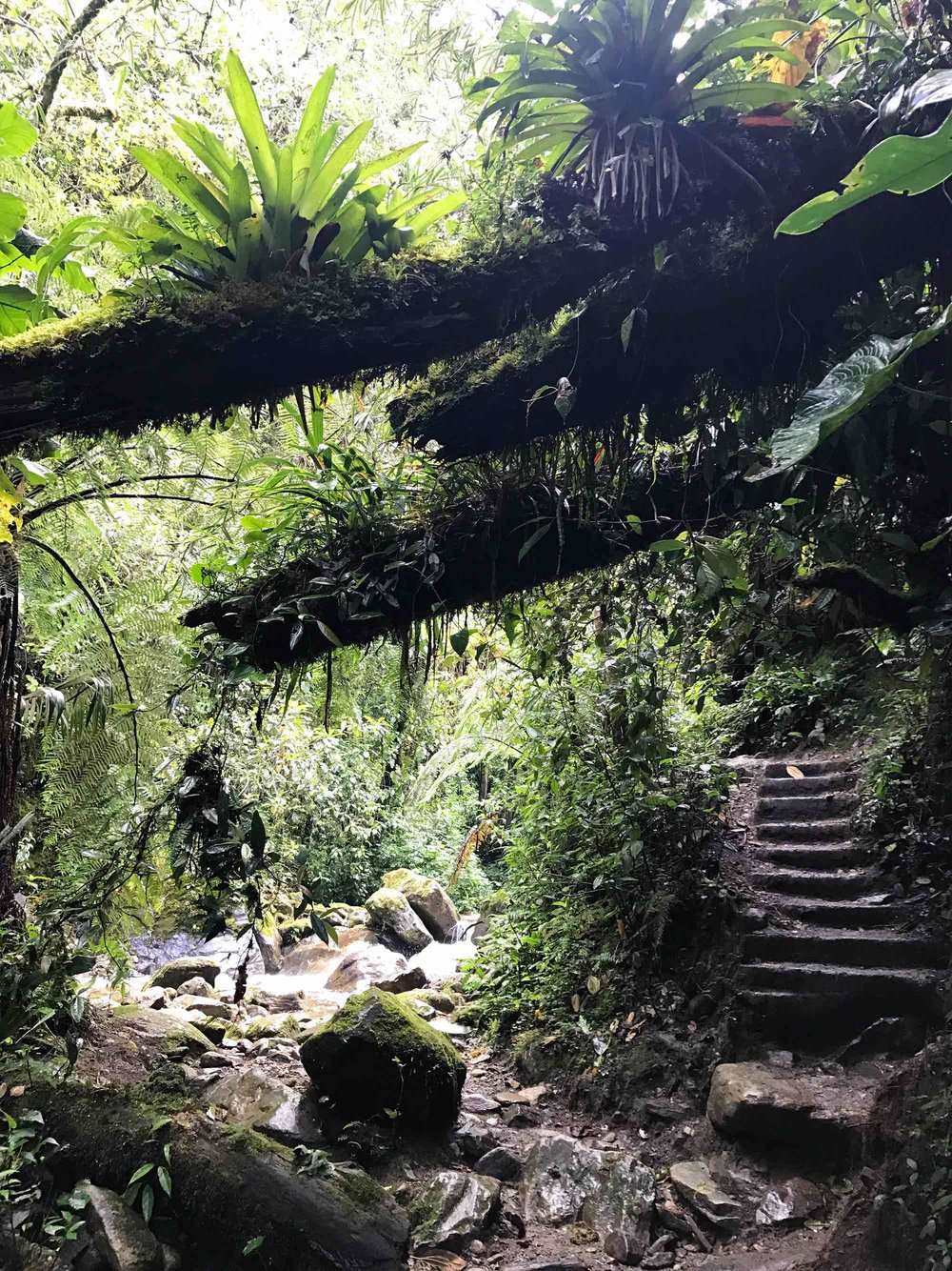
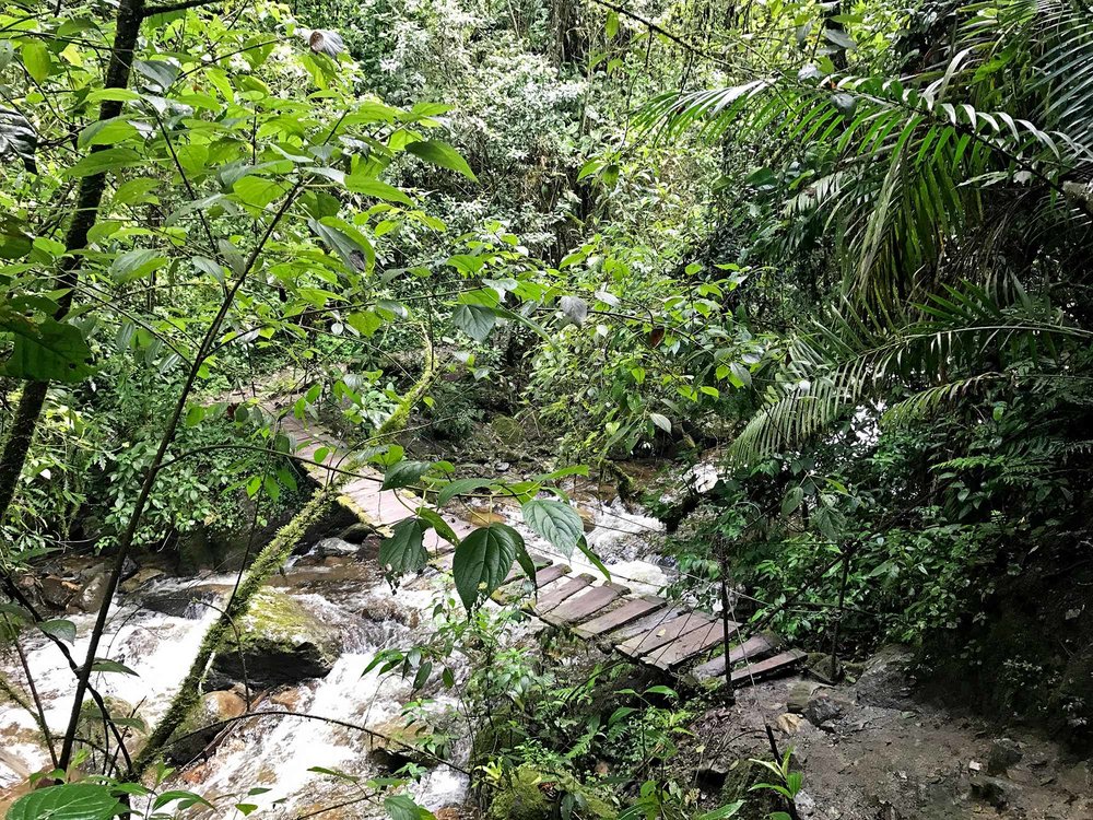
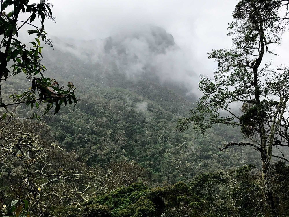
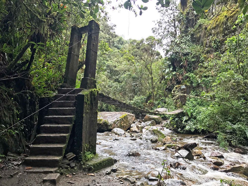
The trailhead greeted us with a stunning array of scenery. Since Cocora Valley is a cloud forest and part of a larger national park, the Los Nevados National Natural Park, the landscape provides ample fields, mountains, trees, creeks, and waterfalls.
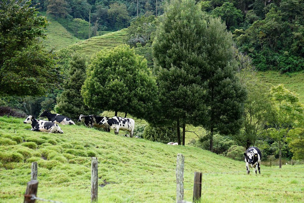
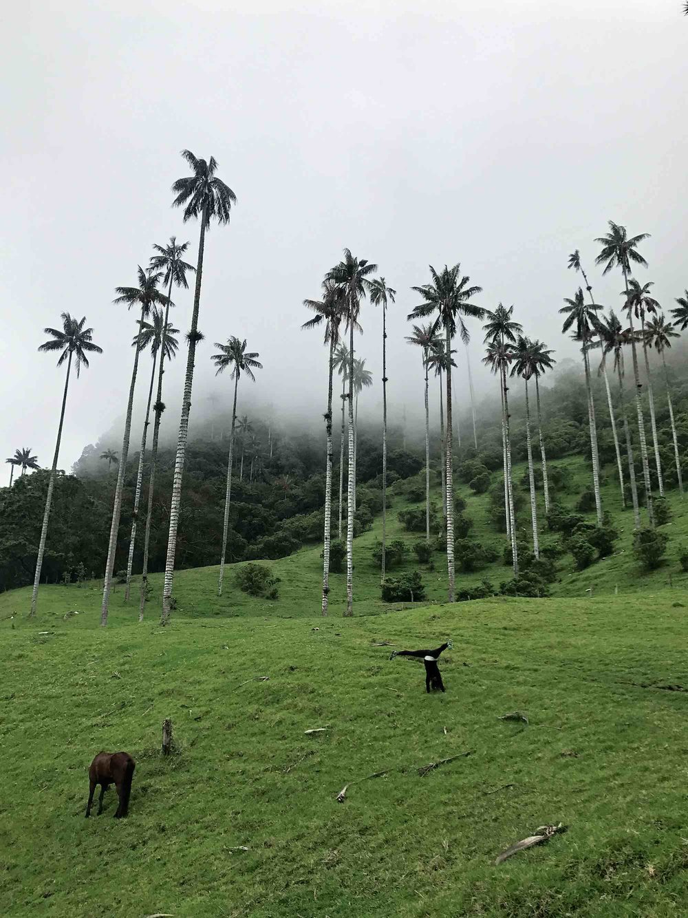
Cows graze nonchalantly in the fields.
Above the ridge, the valley provides a glimpse of these massive palm trees only building anticipation for what was to come.
Open fields and rolling hills became a thick forest of gnarled trees, tangled vines and rushing creeks.
Around 11 am, after roughly three hours of hiking, we really began wondering where we were exactly. We had climbed roughly (height) through thick, slippery mud and the trail seemed to continue on endlessly and we hadn’t seen anyone on the path for over an hour – strange for a hiking trail this popular.
We did take the 7:30am bus instead of the more popular 9:30am to avoid crowds, but it still seemed like we should have seen more people over the last hour or so.
We reached a sign with a map posted on the trail. When we studied it, we were more confused than ever.
When discussing our options for the hike, my friend and I knowingly decided on the more difficult of the two paths – but this seemed outrageous, wrong even.
It was official, we were lost.
We laughed at the irony of our situation.
Luckily at that exact moment, two men briskly walked the trail – coming from the direction we were headed. They were sure footed, confident as if they had walked this trail dozens of times before.
We started chatting with them, we asked them about “the loop” and they pointed us in the direction from which we came. “No, no, the full loop” we emphasized. Again, they pointed us in the direction of where we came, and this time pointed to the wooden map.
After careful deliberation of this new information, it was obvious to us where we went wrong and we began to go back the direction we came.
It was still easy to be in good spirits on the way down - the region is absolutely beautiful. And we did want a more strenuous hike, so we weren’t upset at the extra 2+ hours of hiking nor the incredibly difficult muddy incline.
Yet this “incredibly difficult muddy incline” became a difficult muddy, slippery decline. So we slipped in mud, a lot. Some (my friend) fell more than others (me)!
After roughly 45 minutes of re-tracing our steps, we were back where we believed to be the location of the mix up.
During the climb down, we came across many other people who thought they were doing “the loop” as well, but were really making the same mistake we did.
So they followed us to where we were back on track.
People who took the 9am bus whereas we took the 7am bus so we’d be in the palm forest with as few other tourists as possible.
Once we got to the spot of the mix-up, we quickly realized that the up-hill part of the counter-clockwise hike begins. But we just finished 2 hours of tricky, sticky uphill climbing where everyone else had only been walking flat ground if they didn’t make the same mistake as us.
So we were tired, very tired, often having to stop to catch our breath. We were thankful we had a little group who also made the same mistake who stopped to catch their breath with us.
This climb up the hill to the Finca La Montaña, which is considered the halfway point, would have been a very welcome challenge if we hadn’t made the mistake we did. But we made the mistake, and therefore this hike up was more of a bit more of a burden than it should normally be.
Soon the uphill end was in sight – once we reached Finca La Montaña it was all downhill from there!
At the Finca La Montaña we stopped for a snack and more water as after the detour, the hike was now going to take us longer than expected.
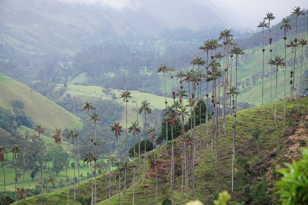
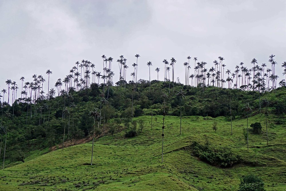
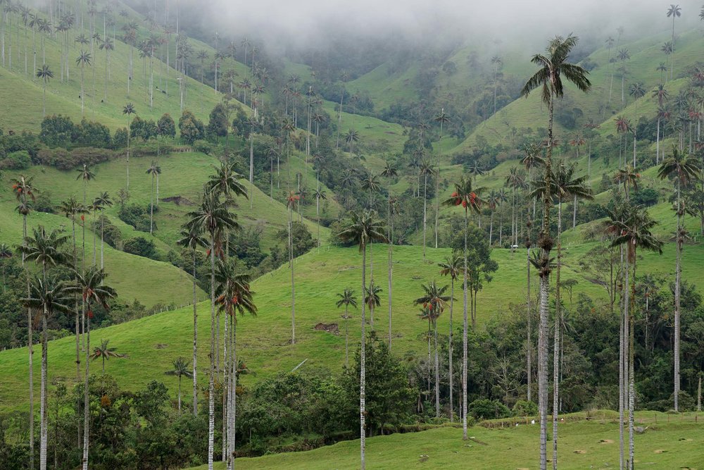
After a break we continued on the path which looked more like a road as it was wide and practically paved. From this road there are many Miradors – or lookout points, to see the iconic wax palms that replaced pine trees.
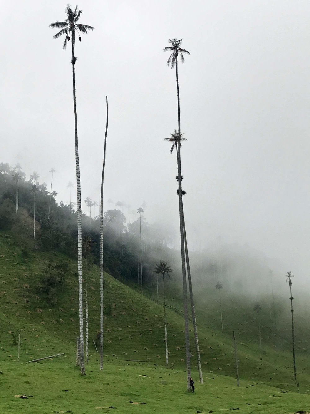
We stopped at a few of these Miradors to get different panorama views of the trees and my goodness the trees are gigantic and impressive! Valle de Cocora stuns with towering palm trees, low hanging mist and vibrant grass.
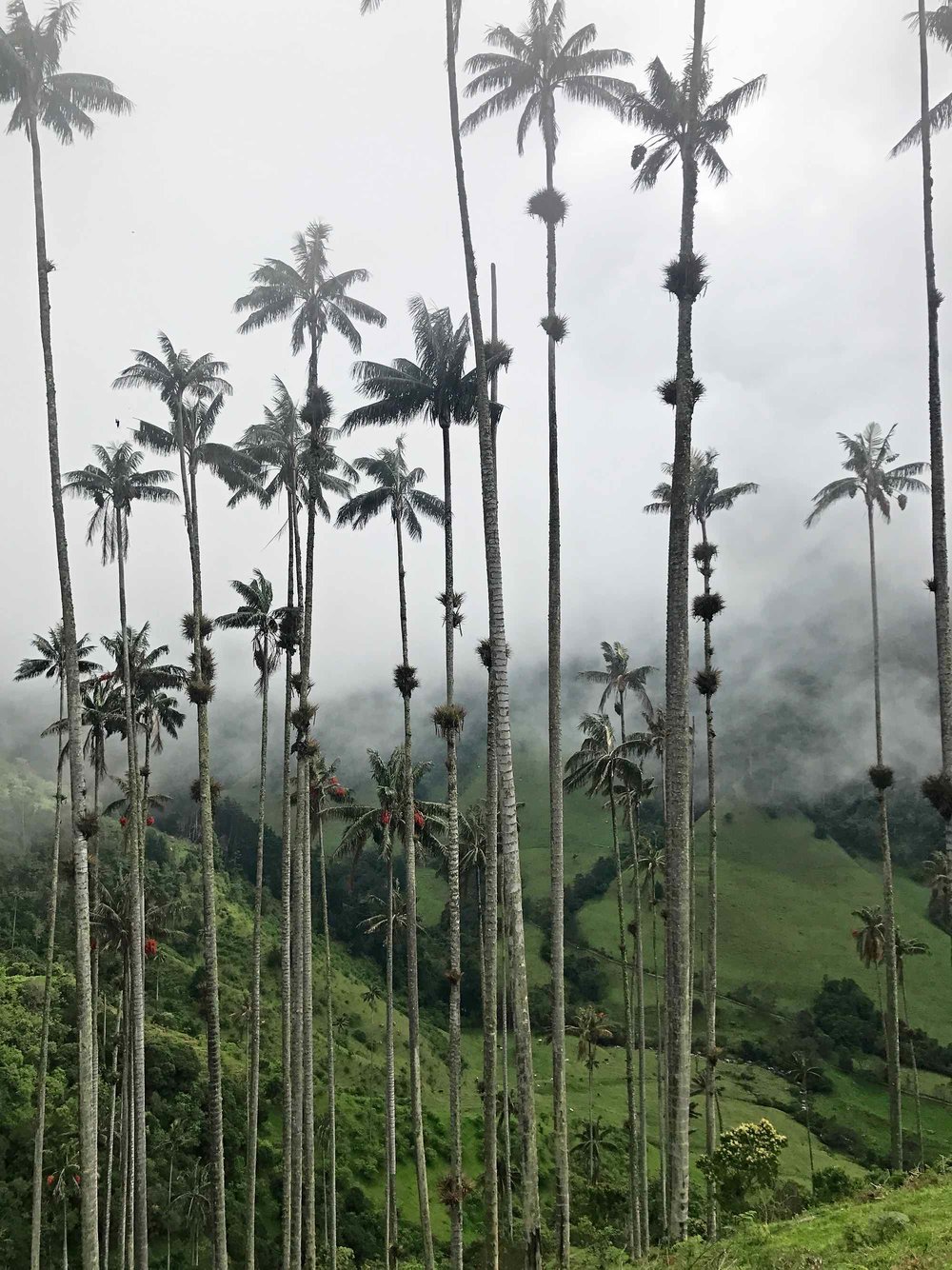
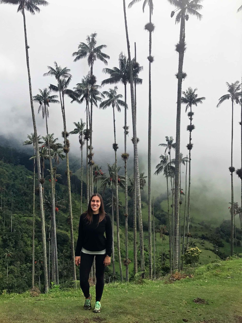
Soon we reached the Bosque de las Palmas – literally translating to “forest of the palms” and is the big open space with views of the wax palms. We frolicked through the monumental trees – hugging them and doing cartwheels – feeling as free as ever.
As we completed the loop, the rain began to fall. I let the water rinse my face with a smile, soaking up the magic that is Valle de Cocora.
the three hiking trail options
There are three options for hiking the Cocora Valley;
The Clockwise “Loop” starting on the left
The Counter- Clockwise “Loop” starting on the right
There and back, starting left
The “loop” is meant to be a 4 to 5-hour journey.
Upon getting dropped off by the jeep, you have two options; walk straight ahead on the dirt road taking the Clockwise Loop path, or go through the blue metal fence on the right for the Counter-Clockwise Loop.
The Clockwise Loop will get you to the wax palms first. It’s also a very steady, gradual incline that almost feels flat for the avid hikers. After you get to Finca La Montaña which is considered to be the halfway point, you’ll hike through a steep descend for roughly 30 minutes making this section hard on the knees.
The Counter-Clockwise Loop puts you through rivers, waterfalls, and bridges first, getting to the wax palms at the end of the hike. The first 1.5 to 2 hours is flat, then it’s becomes steep right before you reach the mid-way point of Finca La Montaña, making this route more challenging on the heart versus the knees!
We choose the loop starting on the right as my friend and I both enjoy difficult hikes, and that's because it ends with the tall palms – the reason we were here, we thought we’d “save the best for last”.
If you do not want to hike the whole loop, or have time to do so, it is possible to walk to the wax palms and then walk back. This is the third option.
For this “There and back”, you’ll start from the left trail head and walk for roughly 30 minutes to the Bosque de las Palmas where you’ll walk amongst the trees. If you want more of a bird’s eye view of the trees, continue walking slightly uphill for another 30-60 minutes for elevated views of the palms, and then just an hour or so to walk all the way back the way you came – making this route only 2.5 hours instead of 4 to 5 hours, and you’ll be hiking on a well maintained road.
While everyone recommends the counter-clockwise loop so that you’ll end with the wax palms, I personally enjoyed the other part of the hike quite a bit, maybe even as much as the wax palms. (Move the 3 hiking trail options section to the beginning to give some background about the hike options before you explain your adventure)
The ONE mistake you do not want to make hiking Cocora Valley
If you’re taking the harder of the options, starting the loop on the right, this is important!
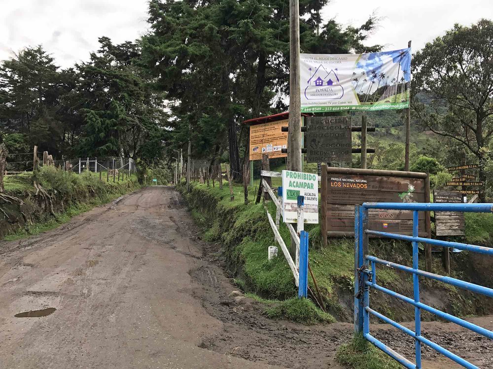
When you come to a grouping of signs, one for the Hummingbird House and one with a red arrow, DO NOT follow the red arrow. Even though there are two different signs, do not follow the solo red arrow which seemingly means for everyone to continue to the right - it does not mean this.

Go left here if you’re doing the Counter-Clockwise Loop starting.
If you’re doing the loop starting on the left (starting with the wax palms) then the trail is much more obvious, you’ll head right instead of straight. Straight will take you to the Hummingbird House, and right will take you to continue the loop.


hiking trail details
We didn’t pay an entrance fee as we started the loop on the right, but if you start on the left you do have to pay. The entrance is only 3,000 COP, which is $1 USD.
Trail is well marked so you don’t need a guide.
Acaime Hummingbird House if off the main trail 2km (1.2 miles), costs 5,000 COP and includes a free drink like coffee. If you’re not up for the detour, follow the trail for Finca La Montaña. DO NOT follow the red arrow pointing to the right, as this is the mistake you do not want to make!
The trail is usually muddy due to the high altitude and the cloud forest climate. Bring the appropriate shoes – and attitude!
Getting to Cocora Valley from Salento
To get from Salento to the trailhead in Cocora Valley, you’ll need to catch a ride.
There are organized Jeeps leaving from the center of town at 6:10 am, 7:30 am, 9:30 am, 11:30 am, 2:00 pm, and 4:00 pm.
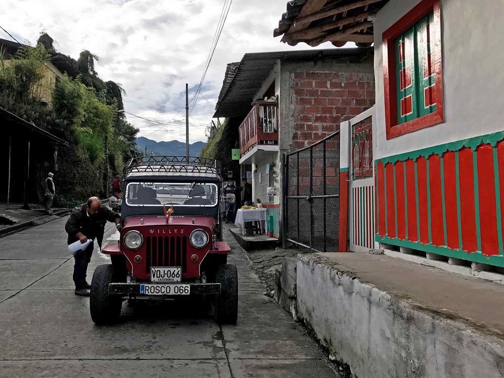
It’s a shared ride, so you’ll have to wait until the Jeep fills up for it to leave, but if you’re leaving at one of the times listed above it’ll be no problem you’ll leave right when you arrive.
The Jeep costs 3,600 COP per person, just over $1 USD. The ride takes roughly 20-30 minutes from Salento to Cocora Valley.
You’ll have no problem finding where the Jeeps leave from, just go to the main plaza and ask any one you see.
Other Tips to Hiking the Cocora Valley, Salento
Go early. Not just to avoid the afternoon crowds, but also because this area is usually rainy and/or cloudy, especially in the afternoon. When I was there the sun shone through the clouds for an hour in the mid morning.
Wear good walking/hiking shoes that you can get muddy, a rain jacket, poncho or umbrella. You could also rent rubber boots at the entrance for 4,000 COP.
Bring water – recommended 1L per person, and snacks.
Visit Colombia
At Sapphire & Elm Travel Co. I’m proud to have been to the country. I don’t plan my clients’ vacations based on vague, outdated or incomplete internet searches, but on personal experience and knowledge.
By traveling to the country ahead of our clients I am able to research and gather insight into the cities, activities, hotels, transportation and more. This way, I can save you precious time, energy, money and hassle while you’re abroad.
Want to discuss if Colombia is right for you? Or your many options for destinations, activities, and how to get around in Colombia? Book a one-on-one travel consultation call to discover your unique options. Or hire me for full-service travel planning.
- explore more -


Save on Pinterest